
Why a Licensed Land Surveyor Should Review Existing Drainage Conditions First
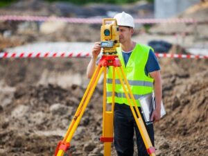 Before any pipe gets moved, a licensed land surveyor builds a field picture of what already exists. This isn’t a general site walkthrough. It’s a focused look at every part of the current drainage system, recorded with survey-grade accuracy.
Design plans get built on assumptions when this step gets skipped. An engineer might assume a pipe sits two feet lower than it actually does. A contractor might assume an outfall connects where old records say it does, and find out on site that it doesn’t. Every one of these gaps costs time once construction starts.
A surveyor removes the guesswork early. Field data becomes the base layer the engineer designs on top of. That’s the difference between a drainage upgrade that goes smoothly and one that stalls halfway through because a crew hit something nobody expected.
Existing Elevations and Drainage Features a Surveyor Checks Before Work Begins
Stormwater systems run entirely on elevation. Water only moves downhill, so every measurement matters. A surveyor typically checks:
- Rim and invert elevations at existing structures, so the new design ties in at the right depth
- Pavement grades and low points across the site, which show where water currently pools
- Existing channels, swales, and open drainage paths
- Connections between the current system and public infrastructure
This is different from a standard topographic survey. A topo survey maps the general shape of a site. This drainage-specific check zeroes in on the components that control water flow. Get an invert elevation wrong by a few inches and a new pipe can end up flowing the wrong direction, or backing up during heavy rain.
In a flat coastal city like West Palm Beach, small elevation differences carry a lot of weight. There’s little natural slope to rely on, so every drainage upgrade depends on getting these numbers right the first time.
How a Surveyor Identifies Property, Easement, and Right-of-Way Conflicts
Drainage improvements don’t always stay inside one property line. Pipes, inlets, and outfalls sometimes need to cross into a drainage easement, run along a right-of-way, or connect to a system that another party maintains. A surveyor identifies exactly where those lines fall before construction plans are finalized.
This step often turns up problems nobody expected. A proposed pipe route might cross into a neighboring easement that limits what can be built there. A planned inlet location might sit within a public right-of-way, which means a separate permit and a different set of construction rules. Access for equipment can also be restricted in areas with recorded easements, which affects how a contractor even gets to the work zone.
Catching these conflicts during survey work costs far less than catching them during construction. A redesign on paper takes a few days. A redesign after equipment is already on site takes weeks, and it usually costs a lot more.
Utility Locations and Other Site Features That Can Affect Stormwater Upgrades
Every drainage upgrade shares ground with something else. Water lines, gas lines, electrical conduit, irrigation systems, retaining walls, driveways, and landscaping all sit somewhere near a proposed drainage route. A surveyor locates these features accurately so the design accounts for them from the start.
Current stormwater project specifications call for exactly this kind of field verification wherever a conflict is possible. It’s not an optional extra. Hitting an unmarked utility line during excavation can shut a job site down, and depending on what gets hit, it can create a safety hazard on top of the schedule delay.
Structures matter here too. A retaining wall or a driveway edge that sits closer to the proposed pipe route than the plans assumed can force a last-minute change. Locating these features before design work is finalized keeps that change on paper instead of in the field.
What the Surveyor Verifies After Stormwater Improvements Are Installed
The surveyor’s job doesn’t end when the pipes go in the ground. After construction, a licensed land surveyor documents the completed locations and elevations of the new drainage features. This creates an accurate record of what was actually built, not just what was originally designed.
Stormwater project documents specifically call for certified final as-built survey information once work wraps up. This isn’t paperwork for its own sake. It confirms the system was built to the approved elevations, gives the property owner a permanent record for future work, and satisfies the certification that permitting agencies require before a project can close out.
This final check protects everyone involved. The contractor has proof the work matches the approved plans. The property owner has documentation that will matter if drainage questions come up years later, during a sale or a future renovation. And the permitting agency gets the certified record it needs to sign off on the project.
A drainage upgrade that starts with an accurate survey and ends with a certified as-built record has the best chance of working exactly as designed, both on paper and in the ground.
Frequently Asked Questions
Why does a drainage upgrade need a survey before it even starts?
Design plans need accurate elevation and location data to work correctly. Without a survey, engineers are designing around assumptions instead of actual field conditions, which raises the risk of a mismatch once construction begins.
What’s the difference between a topographic survey and a drainage-specific check?
A topographic survey maps the general shape and features of a site. A drainage-specific check focuses narrowly on the elevations and structures that control how water moves, like rim and invert elevations, pavement grades, and existing connections.
Can a drainage upgrade cross into an easement or right-of-way?
Yes. Pipes, inlets, and outfalls sometimes need to extend beyond one property line. A surveyor identifies these boundaries early so the design and permitting process account for them before construction starts.
Why does utility locating matter for a stormwater project?
Excavation near unmarked utility lines can cause service disruptions, safety hazards, and schedule delays. Locating utilities before design work finalizes keeps the drainage route clear of conflicts.
What happens after the drainage system is installed?
A licensed land surveyor documents the completed elevations and locations of the new drainage features and provides certified as-built survey information, which many Florida permitting agencies require to close out the project.
For a free land surveying quote, call us at (561) 220-7505 or send us a message by going here.
Posted in land surveying, land surveyor | Tagged cost of land surveying, estimating the cost of land surveying, land surveying cost, land surveying cost West Palm Beach