
LiDAR Mapping for Documenting Features Across Large Sites
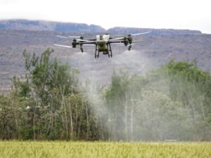 LiDAR mapping collects millions of measured points across a site in a short time, building a detailed record of the ground and everything on it. Developers, engineers, and property owners use that record to plan with fewer surprises. The real value comes from knowing what the data can capture, where it falls short, and how to check that the deliverables fit your project.
What LiDAR Mapping Can Capture Across Large Properties
LiDAR sensors on aircraft, drones, or vehicles send out laser pulses and measure the return from each surface they hit. Every return becomes a point with a location and elevation. Together, those points form a 3D model of the site called a point cloud.
On large properties, that model can include far more than ground elevations. It often captures buildings, tree canopy, fences, roads, ditches, berms, stockpiles, and overhead lines in a single collection. Many projects pair LiDAR with aerial imagery so features can be identified by color and shape as well as height.
Some laser pulses pass through gaps in tree leaves and reach the ground. That lets LiDAR map terrain under moderate vegetation, which is a big advantage on wooded tracts. Very dense underbrush can still limit ground returns, so results vary by site.
Identifying Terrain Changes, Structures, and Site Obstacles
LiDAR data makes terrain changes easy to see across wide areas. Slopes, ridges, depressions, and drainage paths show up clearly in elevation models. Designers can spot low areas and old ditches that aren’t obvious from the ground.
Structures and obstacles also stand out. Common items picked up in LiDAR data include:
- Buildings, sheds, and old foundations
- Power lines, poles, and towers
- Tree stands, hedgerows, and isolated large trees
- Debris piles, stockpiles, and abandoned equipment
LiDAR records surfaces it can see. It won’t find buried pipes, septic tanks, or underground utilities. Standard sensors also struggle to map below standing water, and small items like boundary pins usually need ground survey work to locate reliably.
How LiDAR Data Supports Existing Conditions Documentation
Existing conditions documentation is a record of what’s on a site before new work begins. It helps owners, buyers, and designers agree on the starting point. On large properties, LiDAR can produce that record faster and in more detail than ground methods alone.
The surveyor processes the point cloud into usable products. These may include a bare-earth surface, contour lines, and CAD linework for roads, buildings, fences, and tree lines. Tying the data to survey control keeps it consistent with boundary and topographic surveys.
A dated LiDAR record has value beyond design. It can show conditions before purchase, demolition, clearing, or construction. If questions come up later about grades or features, the record gives everyone something measured to refer back to.
Using LiDAR Mapping for Site Design and Development Planning
Designers use LiDAR surfaces as the base for grading, drainage, and layout plans. Accurate terrain data helps engineers estimate cut and fill, place stormwater ponds, and route roads along workable grades. Better early data often means fewer redesigns later.
Large-site planning also benefits from the bigger picture. Tree height data helps with preservation planning and clearing estimates. Overhead line locations help designers avoid conflicts with entrances, buildings, and construction access.
Phased projects get extra value. One LiDAR collection can support early concept plans, while later phases add ground survey detail where it’s needed. That approach controls survey costs without leaving the design team short on information.
Reviewing LiDAR Deliverables for Accuracy and Project Requirements
Before data collection starts, agree on what you’ll receive and how accuracy will be checked. Good LiDAR projects test results against independent ground points measured by a survey crew. Ask for a short accuracy report that explains the method and results.
Check that the deliverables match your design team’s needs. Review these items with your surveyor and engineer:
- Coordinate system and vertical datum
- File formats for point clouds, surfaces, and CAD files
- Point density and classification of ground, buildings, and vegetation
- Contour interval and linework detail
- Date of data collection
Accuracy needs depend on project scope. Concept planning may accept looser data than final grading planning or permit drawings. Confirm requirements with your engineer and any reviewing agency early, especially if permits or construction schedules depend on the results.
Frequently Asked Questions
What is LiDAR mapping used for on large sites?
LiDAR mapping records terrain and surface features across large areas quickly. Teams use it for existing conditions, grading, drainage, and layout planning. It helps identify slopes, structures, trees, and obstacles before design. The data often becomes the base for engineering plans.
How accurate is LiDAR mapping?
Accuracy depends on the sensor, collection method, ground control, and site conditions. Results are usually checked against ground survey points. Open ground tends to produce tighter results than heavily wooded areas. Ask your surveyor to state expected accuracy and how it will be tested.
Can LiDAR see through trees?
LiDAR can often reach the ground through gaps in tree canopy. That makes it useful on wooded sites where aerial photos can’t see the ground. Very dense underbrush can reduce ground returns. Field checks may be needed in thick areas.
For a free land surveying quote, call us at (561) 220-7505 or send us a message by going here.
Posted in Drone LiDAR Mapping | Tagged Lidar Mapping