
Average Cost for a Land Survey on Irregularly Shaped Parcels
Two lots the same size can cost very different amounts to survey. The average cost for a land survey climbs when a parcel has odd angles, curves, and extra corners instead of four clean sides. Shape drives the price as much as size does, and buyers often learn that the hard way. An irregular parcel means more corners to find, more records to check, and more time in the field. For developers, knowing these cost drivers up front leads to better budgets and fewer surprises in a quote. This guide covers what makes odd shapes cost more, how shape changes the work, research and site factors, terrain and access, and what to include when you ask for an estimate.
What Makes an Irregular Parcel More Expensive to Survey?
An irregular parcel costs more because every extra corner, curve, and odd angle adds field measurements and boundary research a simple rectangle doesn’t need. A four-sided lot has four corners to find and tie together. A parcel with a dozen sides has a dozen, and each one is its own small job.
Curves make it harder still. A curved boundary can’t be measured with a single shot, so the surveyor takes several points along the arc to define it. Odd angles are tougher to close out with the math that proves the boundary fits together. More corners also mean more monuments to locate or set in the ground. All of that extra work adds field time and office time, and both show up in the price.
How Parcel Shape Changes the Work Behind a Land Survey
Shape matters alongside size because the surveyor measures and verifies boundary points, and an odd shape simply has more of them. Acreage tells you how much land there is. It doesn’t tell you how many turns the boundary takes to get around it.
A long, narrow lot has more perimeter than a square lot of the same size. A flag lot, a pie-shaped lot, or a many-sided parcel packs even more boundaries into the same acreage. Each corner needs record research, a field location, and the calculations that tie it back to the deed. Two parcels can both be one acre, and one takes a day while the other takes two. That gap in effort is exactly why the quote for an odd shape runs higher than the quote for a clean rectangle.
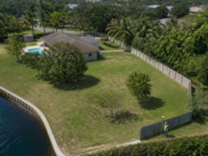
Waterfront and canal lots add their own twist. A shoreline is rarely a straight line, and a boundary that follows water needs extra points to define its shape. That alone can turn a modest lot into a longer job. Shape, in other words, can matter more than the acreage on the deed.
Record Research, Missing Corners, and Other Cost Factors
Price also depends on the paper trail, since old records, missing monuments, and conflicts with neighbors add hours before and after the fieldwork. The surveyor starts with the deed, the plat, and any prior surveys. On an irregular parcel, those descriptions are often older and harder to follow.
Problems in the records cost time to solve. Gaps or overlaps between neighboring descriptions have to be researched and resolved. Missing corner monuments may need to be reconstructed from other evidence, which is careful work. Conflicting calls in old deeds can send the surveyor back to the courthouse for more digging. Adjoining parcels sometimes need a look too, since their lines affect yours. The messier the history, the more research the job takes, and that research is part of what you pay for.
When Terrain and Access Add to the Survey Price
Rough terrain, thick brush, water, and hard access slow the fieldwork and raise the price even on a smaller parcel. The boundary might be simple on paper and still be tough to walk in real life. Site conditions decide how fast a crew can actually move.
Heavy vegetation is a common one. Crews often have to clear sightlines before they can measure, which eats time. Steep or wet ground, canals, and wetland edges make it harder to reach and hold a point. A parcel with no road frontage may force a long walk in with gear. Travel distance and safety concerns add to it as well. Weather can stretch the schedule too, since a wet season turns soft ground into a real obstacle. When the site fights back, the job takes more crew hours, and that lands in the estimate.
What to Include When Requesting a Land Survey Estimate
A useful quote starts with clear details, so give the surveyor the parcel size, the location, the records you have, the survey type you need, and any known boundary issues. The more the surveyor knows before quoting, the tighter and more accurate that number will be. Vague requests lead to padded quotes or later change orders.
Pull together a few things before you call. Have the property address and parcel ID ready, along with any deed, prior survey, or plat you can find. Note the acreage and the type of survey you actually need, since a boundary survey, an ALTA survey, and a topographic survey are priced differently. Flag anything you already know, like a missing corner, a fence dispute, or a hard-to-reach back line. Mention access, too, so the crew can plan. Good information up front is the simplest way to get a fair price and avoid surprises.
Frequently Asked Questions
How much more does an irregular parcel cost to survey than a rectangular one?
There’s no single figure, since the increase depends on how many corners, curves, and record problems the parcel has. A lot with many sides and messy old descriptions can cost noticeably more than a clean rectangle of the same acreage. The extra field time and research are what drive the difference. The most reliable way to know is to request a quote based on your specific parcel.
Why do surveyors charge more for some lots the same size?
Size is only one part of what sets the price, and shape often matters just as much. A parcel with more corners, curved lines, or a complicated history takes more measurements and more research to complete. Two one-acre lots can require very different amounts of work. The quote reflects the effort the boundary demands, not just the acreage.
Can I lower the cost of surveying an irregular parcel?
You can help control the cost by giving the surveyor good information before the work starts. Provide your deed, any prior survey, and the plat, since existing records can cut down research time. Clear access to the property and its corners also saves crew hours in the field. Being upfront about known disputes or missing markers helps the surveyor plan the most efficient approach.